
File:China Shanxi Taiyuan.svg

此SVG文件的PNG预览的大小:705 × 599像素。 其他分辨率:282 × 240像素 | 565 × 480像素 | 904 × 768像素 | 1,205 × 1,024像素 | 2,409 × 2,048像素 | 1,000 × 850像素。
原始文件 (SVG文件,尺寸为1,000 × 850像素,文件大小:217 KB)
| 描述 |
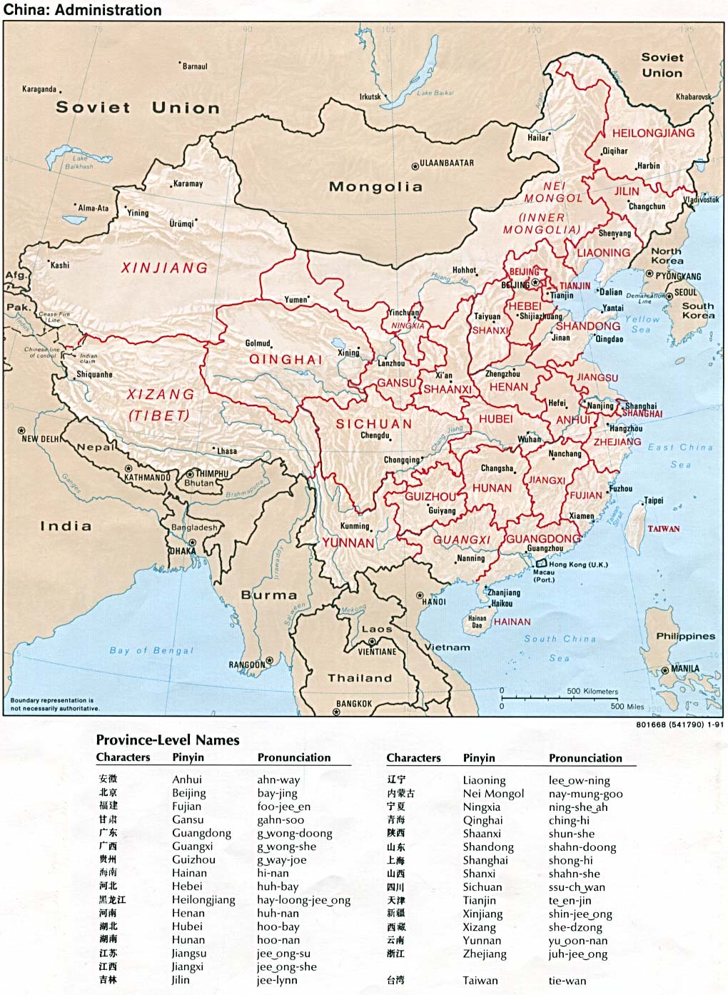
An SVG map of China with Shanxi province highlighted in orange and Taiyuan prefecture highlighted in red Legend: |
||
| 日期 | |||
| 来源 |
self-made; based on CIA public domain maps:
and Wikimedia Commons work: |
||
| 作者 | Joowwww | ||
| 授权 (二次使用本文件) |
|
||
| 其他版本 |
|
||
| SVG开发 |


.png)
文件历史
点击某个日期/时间查看对应时刻的文件。
| 日期/时间 | 缩略图 | 大小 | 用户 | 备注 | |
|---|---|---|---|---|---|
| 当前 | 2010年2月5日 (五) 22:41 | | 1,000 × 850(217 KB) | Joowwww | finalise |
| 2010年2月5日 (五) 13:31 |  | 1,000 × 850(216 KB) | Joowwww | would probably work if I saved the file first | |
| 2010年2月5日 (五) 13:30 |  | 1,000 × 850(216 KB) | Joowwww | thinner brown prefecture borders | |
| 2010年2月5日 (五) 13:27 |  | 1,000 × 850(216 KB) | Joowwww | {{Information |Description=An SVG map of China with Shanxi province highlighted in orange and Taiyuan prefecture highlighted in red Legend:<br />File:China map legend.png |Source=self-made; based on CIA public domain maps: *http://www.lib.utexas.edu |
文件用途
以下2个页面使用本文件:
全域文件用途
以下其他wiki使用此文件:
- af.wikipedia.org上的用途
- ar.wikipedia.org上的用途
- arz.wikipedia.org上的用途
- ast.wikipedia.org上的用途
- bn.wikipedia.org上的用途
- bxr.wikipedia.org上的用途
- ca.wikipedia.org上的用途
- cdo.wikipedia.org上的用途
- ce.wikipedia.org上的用途
- de.wikipedia.org上的用途
- el.wikipedia.org上的用途
- en.wikipedia.org上的用途
- eo.wikipedia.org上的用途
- es.wikipedia.org上的用途
- eu.wikipedia.org上的用途
- fi.wikipedia.org上的用途
- fr.wikipedia.org上的用途
- gl.wikipedia.org上的用途
- id.wikipedia.org上的用途
- is.wikipedia.org上的用途
- it.wikipedia.org上的用途
- ja.wikipedia.org上的用途
- kg.wikipedia.org上的用途
- la.wikipedia.org上的用途
- mn.wikipedia.org上的用途
- mr.wikipedia.org上的用途
- pt.wikipedia.org上的用途
- ro.wikipedia.org上的用途
- ru.wikipedia.org上的用途
- sco.wikipedia.org上的用途
- ug.wikipedia.org上的用途
- uk.wikipedia.org上的用途
- ur.wikipedia.org上的用途
查看本文件的更多全域用途。