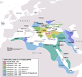
File:OttomanEmpireIn1683-zh-classical.png

本预览的尺寸:637 × 599像素。 其他分辨率:255 × 240像素 | 510 × 480像素 | 816 × 768像素 | 1,088 × 1,024像素 | 1,966 × 1,850像素。
原始文件 (1,966 × 1,850像素,文件大小:442 KB,MIME类型:image/png)
文件历史
点击某个日期/时间查看对应时刻的文件。
| 日期/时间 | 缩略图 | 大小 | 用户 | 备注 | |
|---|---|---|---|---|---|
| 当前 | 2007年5月11日 (五) 06:44 |  | 1,966 × 1,850(442 KB) | Itsmine | |
| 2007年5月10日 (四) 05:31 |  | 1,966 × 1,850(438 KB) | Itsmine | ||
| 2007年5月10日 (四) 05:28 |  | 1,966 × 1,850(438 KB) | Itsmine | ||
| 2007年5月9日 (三) 14:10 |  | 1,966 × 1,850(439 KB) | Itsmine | ||
| 2007年5月9日 (三) 14:01 |  | 1,966 × 1,850(439 KB) | Itsmine | {{Information |Description=Map depicting the Ottoman Empire at its greatest extent, in 1683. |Source=Self drawn, mainly based on ''Robert Mantran (ed.), Histoire de l'Empire Ottoman, Paris: Fayard (1989)'', also [[:en:List of Ottoma |
文件用途
以下3个页面使用本文件:
全域文件用途
以下其他wiki使用此文件:
- vi.wikipedia.org上的用途
- zh-classical.wikipedia.org上的用途
- zh-yue.wikipedia.org上的用途


