
File:PIA16236-MarsCuriosityRover-EtThenRock-20121029.jpg

原始文件 (1,196 × 1,605像素,文件大小:2.51 MB,MIME类型:image/jpeg)
摘要
| 描述 |
English: 10.29.2012
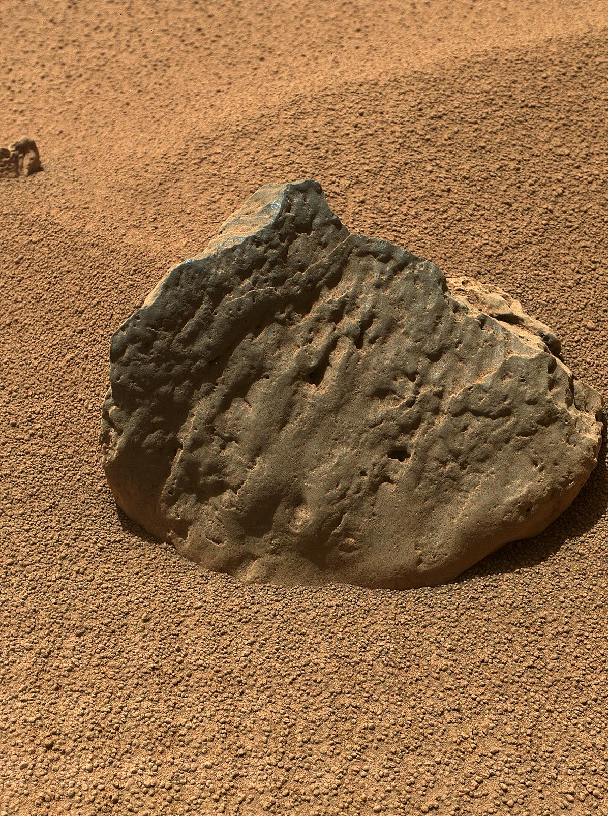
Rock 'Et-Then' Near Curiosity, Sol 82 http://photojournal.jpl.nasa.gov/catalog/PIA16236 The Mars Hand Lens Imager (MAHLI) on the arm of NASA's Mars rover Curiosity took this image of a rock called "Et-Then" during the mission's 82nd sol, or Martian day (Oct. 29, 2012.) The rock's informal name comes from the name of an island in Great Slave Lake, Northwest Territories, Canada. MAHLI viewed the rock from a distance of about 15.8 inches (40 centimeters). The image covers an area about 9.5 inches by 7 inches (24 centimeters by 18 centimeters). Et-Then is located near the rover's front left wheel, where the rover has been stationed while scooping soil at the site called "Rocknest." This is one of three images acquired by MAHLI from slightly different positions so that a three-dimensional information could be used to plan possible future examination of the rock. Image Credit: NASA/JPL-Caltech/MSSS |
| 日期 | |
| 来源 | http://photojournal.jpl.nasa.gov/jpeg/PIA16236.jpg |
| 作者 | NASA/JPL-Caltech/MSSS |
许可协议
| 本文件完全由NASA创作,在美国属于公有领域。根据NASA的版权方针,NASA的材料除非另有声明否则不受版权保护。(参见Template:PD-USGov/zh、NASA版权方针页面或JPL图片使用方针。) | ||
 |
警告:
|
文件历史
点击某个日期/时间查看对应时刻的文件。
| 日期/时间 | 缩略图 | 大小 | 用户 | 备注 | |
|---|---|---|---|---|---|
| 当前 | 2019年1月10日 (四) 17:16 | | 1,196 × 1,605(2.51 MB) | Kesäperuna | 100% JPEG quality from full quality TIFF. |
| 2012年10月30日 (二) 13:51 |  | 1,196 × 1,605(651 KB) | Drbogdan | User created page with UploadWizard |
文件用途
全域文件用途
以下其他wiki使用此文件:
- ar.wikipedia.org上的用途
- de.wikipedia.org上的用途
- en.wikipedia.org上的用途
- es.wikipedia.org上的用途
- lb.wikipedia.org上的用途
- pl.wikipedia.org上的用途
- ru.wikipedia.org上的用途
- sr.wikipedia.org上的用途
- uk.wikipedia.org上的用途
- vi.wikipedia.org上的用途