
File:Low clouds along eastern Taiwan (MODIS 2015-01-23).jpg

原始檔案 (1,400 × 1,800 像素,檔案大小:561 KB,MIME 類型:image/jpeg)
.jpg?uselang=zh-hant)
.jpg?uselang=zh-hant)
.jpg?action=history&uselang=zh-hant)
.jpg)
摘要
| 描述 |
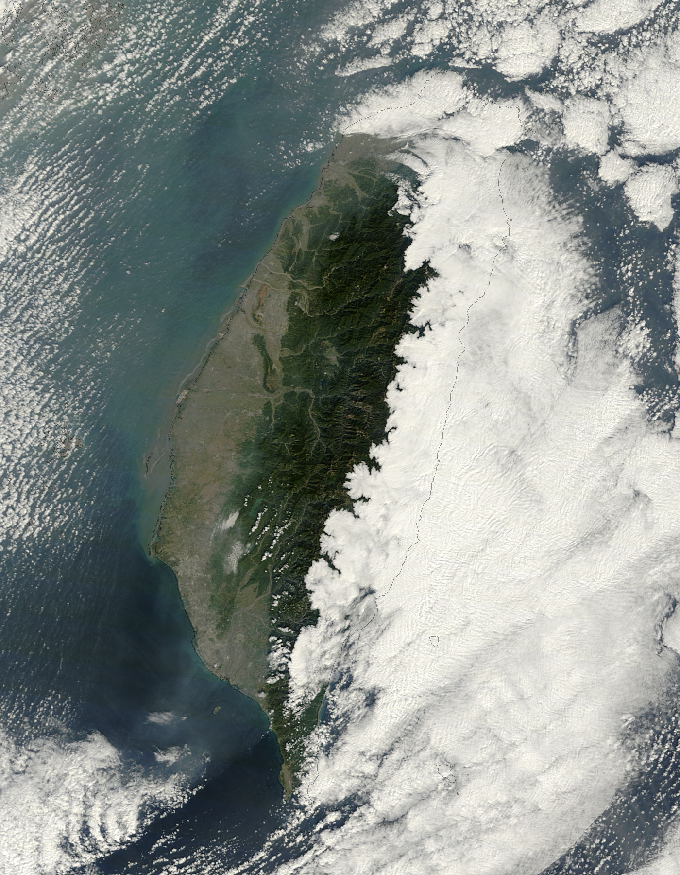
English: Taiwan encompasses about 35,980 sq. km (13,982 sq. mi) of land, distributed between the large island of Taiwan, and the smaller Pescadores, Matsu and Quemoy islands. Overall, the land mass is slightly smaller than the states of Maryland and Delaware. Sitting off the coast of southern China, Taiwan is surrounded by the East China Sea, the South China Sea and the Pacific Ocean.
The Central Mountains (also known as the Chungyang Range) form the rugged spine of Taiwan, running from the south to near the city of Taipei, on the northern tip of the island. The land to the west of the ridgeline of the mountains gently descends to sloping plains; to the east the land is rough and mountainous almost to the coastline. Taiwan�s diverse habitat has fostered a large diversity in flora and fauna. Taiwan has about 3,800 plant species, with about one-third of the total flora indigenous. About 60 species of mammals, including the Formosan black bear and pangolins are reported on the island, along with 330 species and subspecies of birds which either live or visit there. Amid all this diversity, one thing remains widespread and common, especially east of the Central Mountains: fog. Although not always present, low clouds are not an unusual feature, and several tourist sites remind visitors that slight trip delays due to fog are always a possibility. The Moderate Resolution Imaging Spectroradiometer (MODIS) aboard NASA�s Terra satellite captured this true-color image of a winter�s day in Taiwan. The western two thirds of the country are easily viewed from space, as well as the tan sediment swirling in the Taiwan Strait. From the summit of the Central Mountains to the east over the Pacific Ocean, however, the land and sea are completely obscured by a large bank of low cloud (fog). |
||
| 日期 | 攝於2015年1月17日 | ||
| 來源 |
Low clouds along eastern Taiwan (direct link)
|
||
| 作者 | Jeff Schmaltz, MODIS Land Rapid Response Team, NASA GSFC |
| This media is a product of the Terra mission Credit and attribution belongs to the mission team, if not already specified in the "author" row |
授權條款
| 本作品由NASA創作,屬於公有領域。根據NASA的版權政策:“NASA的創作除非另有聲明否則不受版權保護。”(參見:Template:PD-USGov/zh,NASA版權政策或JPL圖像使用政策) | ||
 |
警告:
|
檔案歷史
點選日期/時間以檢視該時間的檔案版本。
| 日期/時間 | 縮圖 | 尺寸 | 使用者 | 備註 | |
|---|---|---|---|---|---|
| 目前 | 2024年2月8日 (四) 22:02 | | 1,400 × 1,800(561 KB) | OptimusPrimeBot | #Spacemedia - Upload of http://modis.gsfc.nasa.gov/gallery/images/image01232015_250m.jpg via Commons:Spacemedia |
檔案用途
下列頁面有用到此檔案:
.jpg)