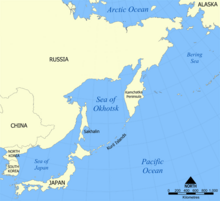
File:Kwangmyongsong-2 ICAO danger zones.png

本预览的尺寸:657 × 599像素。 其他分辨率:263 × 240像素 | 526 × 480像素 | 990 × 903像素。
原始文件 (990 × 903像素,文件大小:135 KB,MIME类型:image/png)
文件历史
点击某个日期/时间查看对应时刻的文件。
| 日期/时间 | 缩略图 | 大小 | 用户 | 备注 | |
|---|---|---|---|---|---|
| 当前 | 2010年4月23日 (五) 17:20 |  | 990 × 903(135 KB) | Ras67 | cropped |
| 2009年4月8日 (三) 15:16 |  | 1,000 × 913(128 KB) | Mahahahaneapneap | Compressed | |
| 2009年4月6日 (一) 19:32 |  | 1,000 × 913(155 KB) | 84user | {{Information |Description= {{en|1=This map shows the approximate areas of the ICAO-reported danger zones for the launch of Kwangmyŏngsŏng-2 by North Korea. Derived from a map made by NormanEinstein, October 24, 2005.}} |Sou |
文件用途
以下页面使用本文件:
全域文件用途
以下其他wiki使用此文件:
- en.wikipedia.org上的用途
- fr.wikipedia.org上的用途
- pt.wikipedia.org上的用途
- ru.wikipedia.org上的用途
- zh.wikinews.org上的用途


